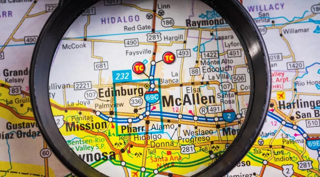
A map can tell us a lot about a place. It’s like a snapshot of a city, showing us its layout, landmarks, and unique features. So, what does a McAllen, Texas map reveal about this vibrant city in the southern part of the state? Let’s dive into what a map of McAllen can teach us about its geography, attractions, and character.
The Basic Layout of McAllen
McAllen is located in the Rio Grande Valley, near the southern tip of Texas. If you look at a map, you’ll see that it’s close to the U.S.-Mexico border. The city is relatively flat and has a layout that’s easy to navigate. Major roads like Interstate 2 and U.S. Highway 83 cut through the city, making it simple to travel from one side to another.
McAllen is laid out in a grid pattern, with streets running parallel and perpendicular to each other. This kind of layout helps make the city easy to understand and get around. If you need to find a specific place, you can usually locate it by knowing its street address.
The Main Areas of McAllen
When you look at a McAllen map, you’ll notice several key areas:
- Downtown McAllen: This is the heart of the city. You’ll find many businesses, restaurants, and cultural sites here. Downtown is known for its vibrant atmosphere and historical buildings. If you’re looking for the city’s pulse, this is the place to be.
- North McAllen: This area is more residential and features a mix of older and newer homes. It’s also where you’ll find some of the city’s larger parks and schools. North McAllen is known for its family-friendly environment.
- South McAllen: This part of the city is growing rapidly. It’s where many new developments are happening, including shopping centers and new housing. South McAllen is becoming a hub for those looking for modern amenities.
- West McAllen: West McAllen is known for its spacious properties and more suburban feel. It’s an area where you can find larger homes and more green space.
- East McAllen: This area is close to the McAllen-Miller International Airport and is known for its commercial development. It’s a busy area with lots of businesses and retail options.
Key Landmarks and Attractions
A map of McAllen will also point out several key landmarks and attractions:
- McAllen Convention Center: Located near the heart of the city, this large facility hosts various events, including conventions, concerts, and trade shows. It’s a central spot for business and entertainment.
- La Plaza Mall: This is a major shopping destination in McAllen. On the map, you’ll see it marked in the central part of the city. It offers a variety of stores and dining options.
- McAllen Public Library: The library is a notable landmark in McAllen. It’s not just a place to borrow books but also a community center with various programs and events.
- Botanical Gardens: McAllen is known for its beautiful gardens. The map will show several green spaces where you can enjoy nature and learn about local plants.
- Anzalduas Park: This park is located near the border and offers stunning views of the Rio Grande River. It’s a great place for picnics and outdoor activities.
The Diversity of McAllen
McAllen is a melting pot of cultures, and a map can reveal this diversity through its neighborhoods and community centers. The city has a rich blend of Mexican-American culture, which is reflected in its festivals, food, and community events.
For example, the map might show areas with a high concentration of Mexican restaurants and shops. These places are not just businesses; they are part of the cultural fabric of McAllen. They offer a taste of local traditions and help to keep the community’s heritage alive. You Can Also Read This The Texas McAllen Zip Code Explained
The Economy and Commerce
McAllen is an economic hub for the Rio Grande Valley. On a map, you’ll see various commercial areas and business districts. The city’s economy is driven by retail, healthcare, and international trade, especially with Mexico.
- Retail: McAllen is known for its shopping centers, including large malls and smaller boutiques. These retail spaces are dotted across the map, particularly in the central and southern parts of the city.
- Healthcare: The map will also show the locations of major hospitals and medical centers. McAllen is a center for healthcare in the region, and these facilities are crucial to the city’s economy and well-being.
- International Trade: Given its proximity to the Mexican border, McAllen plays a significant role in international trade. You’ll find numerous logistics and transportation companies in the area, especially near the border crossings.
Transportation and Accessibility
McAllen is well-connected by road, and a map will highlight the main transportation routes.
- Major Roads: Highways like I-2 and US-83 are key routes that run through McAllen. These roads connect the city to other parts of Texas and beyond.
- Public Transportation: The city has a public bus system that serves various neighborhoods. On a map, you’ll find bus routes and stops that make it easy to get around without a car.
- Airport: McAllen-Miller International Airport is a major transportation hub. It’s conveniently located near the city and is marked on the map as a key point for travel and commerce.
Residential Areas and Housing
If you look closely at a McAllen map, you’ll see different types of residential areas. The housing in McAllen ranges from historic homes in older neighborhoods to modern developments in newer parts of the city.
- Historic Homes: These are usually located in the central and northern parts of McAllen. They add character to the city and are often surrounded by mature trees and established gardens.
- New Developments: In areas like South McAllen, you’ll see newer housing developments with modern designs and amenities. These areas are popular with families and professionals looking for updated living spaces.
Education and Schools
Education is an important part of McAllen’s community. A map will show the locations of various schools and educational institutions, including:
- Public Schools: McAllen has several public schools spread across the city. They are important landmarks for families living in the area.
- Private Schools: There are also private schools in McAllen, offering various educational options. These schools are marked on the map and are known for their specialized programs and smaller class sizes.
- Higher Education: The city is home to higher education institutions, including community colleges and universities. These are important for students pursuing further education and training.
The Community and Culture
A map of McAllen also highlights various community and cultural spots that make the city unique. These include:
- Cultural Centers: McAllen has several cultural centers that celebrate its diverse heritage. These centers often host events, exhibits, and performances.
- Festivals and Events: The city is known for its vibrant festivals, which can be seen on the map through event spaces and public parks where these celebrations take place.
- Restaurants and Entertainment: The map will show numerous dining and entertainment options throughout McAllen. From local eateries to theaters and concert venues, these places add to the city’s lively atmosphere.
Conclusion
A map of McAllen, Texas, reveals much more than just streets and landmarks. It provides insight into the city’s layout, key areas, and the vibrant life that defines McAllen. Whether you’re planning a visit or looking to understand more about the city, a map is a valuable tool that showcases the diverse and dynamic character of this southern Texas gem.